Government officials on Sunday began their assessments of the damage inflicted upon Hawaii Island from Hurricane Lane.
Janet Snyder, spokeswoman for Mayor Harry Kim, said teams including county workers, Federal Emergency Management Agency officials, the American Red Cross and Community Emergency Response Team members “started fanning out to do the first run of damage assessments.”
“They went to people’s houses as well as county facilities and commercial enterprises,” Snyder said. “… We have to do these damage assessments so we can qualify not only for any state assistance that’s available, but also to take it to the next step, the federal level, like we did with the (Kilauea lower East Rift Zone) eruption.”
“I think we’re going to find a lot more damage than we initially thought as folks go into these pockets of population. A lot of folks have issues. So we’ll find out more,” added Talmadge Magno, county Civil Defense administrator.
East Hawaii — already reeling from the eruption that destroyed more than 700 homes and caused extensive damage to Hawaii Volcanoes National Park and four state highways before stopping or entering a period of dormancy early this month — is now facing an uphill battle to recover from the effects of a four-day rainfall of historic proportions.
Mountain View received 51.53 inches of rain between noon Wednesday and 4 a.m. Sunday.
The National Weather Service said that’s “a preliminary total subject to final quality control,” but described the deluge, which destroyed two homes in Hawaiian Acres subdivision, as the “third highest storm total rainfall from a tropical cyclone in the United States since 1950.”
The record is 60.58 inches, measured at Nederland, Texas, during Hurricane Harvey last year. The second highest total — and the highest tropical cyclone storm total rainfall in Hawaii — is 52 inches, measured at Kanalohuluhulu Ranger Station on Kauai during Hurricane Hiki in 1950.
Hilo International Airport tallied 36.76 inches of rain for the four-day period between midnight Wednesday and 11:59 p.m. Saturday. That’s the wettest four-day period ever observed in Hilo, with records dating back to 1949. Hilo also received 15 inches on Friday, making it the fifth wettest calendar day on record.
Other rainfall totals in inches for the period between noon Wednesday and 4 a.m. Sunday include: Waiakea Uka, 49.10; Piihonua, 47.48; Saddle Quarry, 47.20; Waiakea Experimental Station, 43.99; Pahoa, 37.28; Glenwood, 35.40; and Kulani, 28.52.
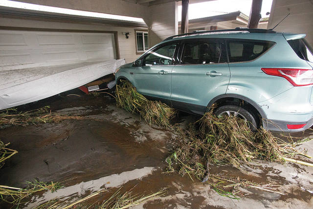
Rain bands associated with Lane produced torrential rainfall over the Big Island’s slopes from Hawi in North Kohala to Naalehu in Ka‘u. Significant flash flooding occurred in multiple areas across northeast- and east-facing slopes of the island.
Several evacuations occurred, with rescues taking place at Kaiulani Street on Reed’s Island in Hilo, Waipio Valley and Keaau Agricultural Lots subdivision.
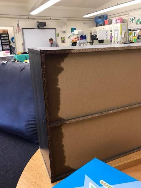
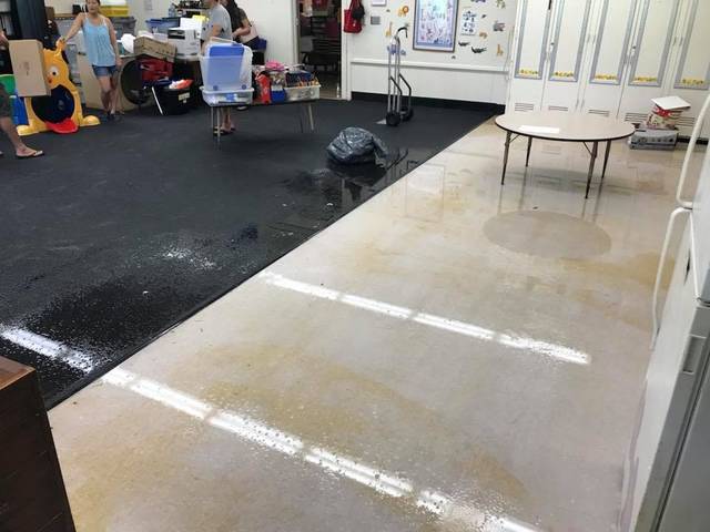
State Sen. Kai Kahele noted on Facebook that he visited Waiakea Elementary School in Hilo on Sunday after principal Ken Watanabe informed him there was major flood damage in a building housing preschool, special education and kindergarten classrooms.
“Lots of volunteers extracting allot (sic) of water and moving furniture but most of the building is soaking wet with the smell of mold and mildew settling in,” Kahele wrote. “This will take a concerted effort by the State DOE and FEMA to address this and the 155 students and teachers affected.”
As usual during heavy rains, the Hilo Bayfront was inundated by the overflow of Alenaio Stream. Highway 19 was closed in multiple locations, including Kaawalii Gulch and Honomu, due to landslides and flooding. Akoni Pule Highway in North Kohala was closed by a landslide near Halawa Gulch. Highway 130 was closed by flooding south of Keaau. Numerous secondary roads were also closed by flooding.
“After all this, state and county funds are stretched to the max,” Snyder added. “… Harry said we’ll do everything we can to identify individuals who have damage so people can expect people from the county and other government agencies to do either private sector or public sector assessments.”
Tom Travis, Hawaii Emergency Management Agency executive officer, said the Big Island is “at the point now that assessment is critical so we can get the aid if it’s available.”
Asked if he thinks the damage to the island meets federal guidelines for monetary help from FEMA, Travis replied, “I do not know. And I’m not saying that as a political answer.”
“The county’s taking the lead and we’re pushing very, very hard to find out the answers to those questions as rapidly as we can,” he said. “But there’s a chance, so we’ll put the data together. And if the data supports it, we’ll put in a request.”
Snyder said the mayor advises anyone who experienced storm damage to document their damage and contact their insurance agents as soon as possible.
“He noted that all private policies don’t cover flood damage. You have to be in the federal program. So make sure that you have that for flood damage,” Snyder said.
To report flood damage from the storm, call 643-5555.
While Lane, which was a tropical depression as of Friday evening, continues its westward track away from the islands, Tropical Storm Miriam has emerged in the Eastern Pacific.
As of 5 p.m. Sunday, Miriam was 1,840 miles east-southeast of Hilo, gradually strengthening with maximum sustained winds of 50 mph with locally higher gusts. The storm was moving westward at 14 mph. Tropical-storm-force winds extend outward up to 45 miles from the center.
Additional strengthening is forecast, and Miriam is expected to become a hurricane by late today or early Tuesday.
“We’re watching it; we’re looking at it with the forecasters …. I guess it’s not coming into our waters until Friday. If there’s going to be any impacts, it’ll probably be Monday. So it’s a week out, basically,” Magno said.
In addition, a broad low-pressure front in the Pacific about 500 miles south-southwest of Manzanillo, Mexico, is producing showers and thunderstorms.
According to the National Hurricane Center, environmental conditions are forecast to be conducive for this disturbance to develop into a tropical depression later this week while the system moves westward to west-northwestward at 10 mph.
Heavy rain and possible thundershowers left over from Lane are forecast to continue through today and possibly into Tuesday, so use extra caution on roads and take time to get to your destination safely. Closures may occur without any notice.
“We’re still in the middle of hurricane season. There are other (tropical cyclone) systems on their way. But folks who have damage, definitely report it. … Call the hotline … and somebody will come visit you and see what you’ve got,” Magno said.
For your additional information:
• All schools and the University of Hawaii are open today.
• All county parks and facilities and all state parks and facilities are open except the Wailoa Visitor Center.
• All DLNR outdoor recreation areas and reserves will remain closed for further assessment.
• State Highways Division reports all major roads are open; use caution on Highway 11 and 19 as each have a single-lane closures and ongoing repairs.
• The Disaster Recovery Center at Pahoa Community Center is also open during its normal business hours, 8 a.m.-6 p.m. weekdays and 8 a.m.-4 p.m. Saturdays
The state Department of Health is advising the public to stay out of streams, coastal, and standing waters that are contaminated by storm water. Storm water may contain harmful microorganisms from overflowing cesspools or septic tanks as well as animal waste washed into streams and storm drains.
The current map of road closures can be found at http://www.hawaiicounty.gov/2018-hurricane-map.
Email John Burnett at jburnett@hawaiitribune-herald.com.


