Mayor Harry Kim told department heads and emergency workers Monday he intends preliminary assessment of the damage done by former Hurricane Lane to be completed expeditiously.
“We hope to finish most of what they need by today and tomorrow,” Kim said during a morning briefing at Civil Defense headquarters in Hilo.
The goal is to ascertain whether damage done by the storm is sufficient to meet federal guidelines for monetary assistance to the county and to homeowners who suffered damage.
Lane spared the Big Island its winds, but rain fell in historic proportions in East Hawaii, with Mountain View receiving 51.53 inches between noon Wednesday and 4 a.m. Sunday.
“Fortunately, the weather has passed. Now we just have to deal with the aftermath,” said county Civil Defense Administrator Talmadge Magno.
Bill Hanson with Civil Defense said six teams canvassed the Hilo area to begin damage assessment Sunday.
“We’ll be canvassing other areas today,” Hanson said Monday. He said canvassing teams have 140 “line items” on their checklists.
It’s still too early to quantify the extent of the damage, but it runs the gamut from flooded homes to washed-out roads, said Civil Defense spokeswoman Kelly Wooten.
“We don’t really have any numbers or statistics back yet,” she said.
The storm’s damage was mostly in East Hawaii, where rivers and streams, especially the Wailuku River — which means “waters of destruction” — raged, and nearly 40 people had to be rescued from homes.
Fortunately, there were no deaths from the storm, which had the potential to cause much more destruction.
Some 200 people have called to report some kind of damage, mostly on the east side of the island, said county Managing Director Wil Okabe.
“What we’re concerned about is the mold — when it goes into the drywall, the rug, stuff like that,” Okabe said.
On Sunday, state Sen. Kai Kahele surveyed flood damage at Waiakea Elementary School in Hilo. Six classrooms for preschool, special education and kindergarten students flooded and the smell of mildew was settling in, he said.
“I think it’s reflective of what you see all over East Hawaii,” he said. “Four feet of water in three days overwhelmed even the best infrastructure and the best storm drains and plans.”
As the island continued to clean up from the storm, some people were feeling like it could have been worse if Lane remained a hurricane and unleashed destructive winds.
“People just want the rain to stop,” Kahele said. “People are tired of being wet.”
While Lane has moved hundreds of miles to the west, rain continued to fall on the already waterlogged landscape, causing the National Weather Service to issue a flash flood warning for the Big Island Monday afternoon.
This time, the leeward side of the island bore the brunt of the rainfall, with Waikii receiving 4.47 inches of rain in the 24-hour period ending at 2 p.m.
Civil Defense reported that the Old Saddle Road was closed between Waikii and the Daniel K. Inouye Highway junction because of heavy runoff.
Other leeward spots receiving significant rainfall in the same 24-hour period included: Puuwaawaa, 2.21 inches; Kiholo, 1.67 inches; Pohakuloa Kipuka Alala, 1.38 inches; Ahumoa, 1.09 inches; Pohakuloa West, 1.01 inches; Honaunau, 0.76 inches; and Kealakekua, 0.73 inches.
Rainfall totals for windward Big Island locations for the previous 24 hours ending at 2 p.m. included: Pahoa, 1.6 inches; Mountain View, 1.42 inches; Waiakea Experimental Station, 1.12 inches; Glenwood, 1.08 inches; Waiakea Uka, 0.99 inches; and Hilo International Airport, 0.94 inches.
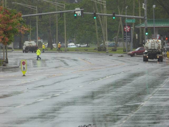
Schools and government offices reopened Monday after three days of closures last week, but Kamehameha Avenue in Hilo remained closed between Ponahawai Street and the Hilo Ironworks Building, while a crew worked to clear the roadway, which was no longer flooded, of debris.
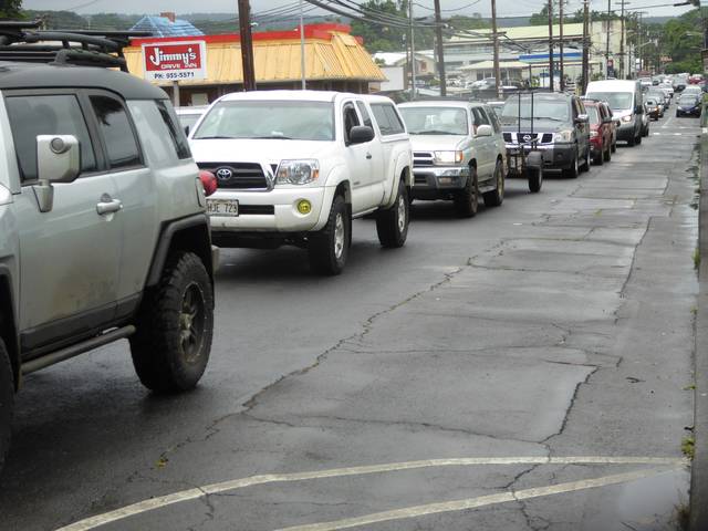
The closure of the major crosstown thoroughfare caused traffic backlogs on Kilauea Avenue and Kinoole Street downtown.
“I’ve been in this lane for 25 minutes,” said a woman in a sport-utility vehicle waiting in mid-afternoon traffic to turn left from Kinoole onto Ponahawai. “I left the office 10 minutes early because I knew it would be like this.”
National Weather Service meteorologist Vanessa Almanza said relief could be on the way for water-weary Big Islanders.
“We’re expecting some drier air to move in (tonight) into Friday,” Almanza said.
That said, a couple of potential threats to Hawaii are being watched in Eastern Pacific waters.
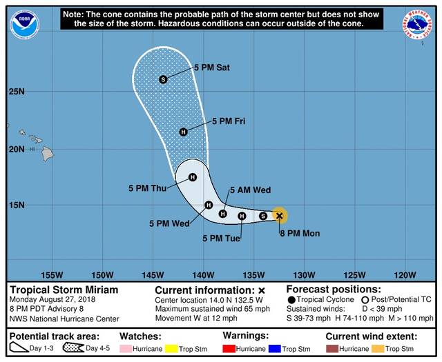
As of 5 p.m. Monday, Tropical Storm Miriam was 1,540 miles east-southeast of Hilo. Maximum sustained winds were at 65 mph and the storm was moving west at 12 mph. This track is expected to continue for the next couple of days, according to the National Hurricane Center.
Tropical storm force winds extend outward up to 60 miles from the center. Additional strengthening is forecast during the next two to three days, and Miriam was expected to become a hurricane Monday night or early today.
The current forecast track has Miriam taking a hard turn north just as it crosses the 140-degree longitude line into Central Pacific waters. If that track holds, it would pass far east of the Big Island on Friday or Saturday.
In addition, showers and thunderstorms associated with an area of low pressure located about 500 miles south of the southern tip of the Baja California peninsula had changed little on Monday. However, according to the National Hurricane Center in Miami, conditions are still favorable for development of a tropical depression while the system moves west-northwest to northwest at 10 to 15 mph.
“Nothing looks like it’s going to make it to us at this time. Keeping our fingers crossed,” Magno said.
The Associated Press contributed to this story.
Email John Burnett at jburnett@hawaiitribune-herald.com.


