State resumes planning for Kealakekua Bay
As state officials announce planning has resumed for Kealakekua Bay State Historical Park, residents and users seem to agree a blueprint is needed to address parking shortages, shabby infrastructure, lack of toilets and people defecating on sacred ground.
ADVERTISING
Only this time, they want to see something actually get done.
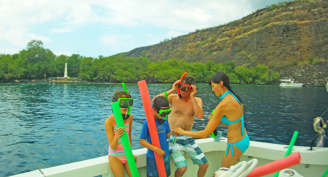
A master plan has been in the works for years to protect the area’s stunning beauty and cultural resources, while balancing commercial and visitor use with the rights of those who live along the shores of what is arguably the most historically significant body of water in the state.
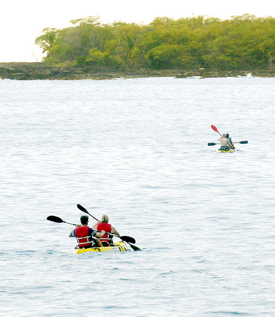
Along these lines, the state has fallen far short of doing enough, say residents, who point to toilet-paper-strewn bushes at Kaawaloa, lack of parking and restrooms along the east side of the bay, people intruding on private property to launch kayaks, and a locked gate that appears to block access to scarce public parking without any reason.
Sporadic planning stretches back through the decades. The latest round started in 2008 for 221 acres around the bay, but the inclusion in 2012 of the bay itself and the Napoopoo landing and wharf area increased the park size, giving planners another 315 acres to study. This month, state parks officials and consultant Belt Collins Hawaii LCC will resume studies of the bay’s resources, traffic and parking, and begin a survey of marine resources and ocean recreation.
These efforts — plus a public meeting in late summer or early fall to gather input from the community — are geared toward creating a draft management plan, to be followed by an environmental impact statement.
With a new chairwoman of the state Department of Land and Natural Resources having Big Island ties and a background in conservation, a group of villagers and users has begun mobilizing to push county and state officials and stakeholders to find solutions, said Gordon Leslie, who traces his lineage back generations along the bay.
“In addition to this big master plan, there is an immediate need that we must address,” Leslie said.
Part of what his group envisions for the bay is a 3-acre parking lot off Napoopoo Road about 300 feet mauka of the water, where kayak vendors can consolidate. This would help eliminate vendors having to “hustle” along the edge of the road and launch from areas that interfere with residents, Leslie said.
“These vendors are the economic engine of this village, but they are treated like second-class citizens,” Leslie said.
A 5-acre area of county land could be turned into parking for Manini Beach so vehicles would not edge onto private property. And things need to change at Kaawaloa, Leslie said.
“You cannot land at Kaawaloa,” he said. “They never took into consideration the rights of the indigenous people. I have many of my family buried there, but I cannot land there from the water. But 80 to 100 people a day hike down along the Kaawaloa Trail. It’s at least a six-hour hike, and when you gotta go, you gotta go, and there is toilet paper all over the place. And this is sacred ground.”
Composting toilets and parking would go a long way to addressing immediate problems, and they wouldn’t require years of planning or huge money, Leslie thinks.
Besides the value of abundant reef life, coral and spinner dolphins, the significance of the bay’s heiau, alii compound, religious complexes and other sites is not lost on the state, DLNR officials say.
“We recognize the need to integrate planning for the bay and ocean recreation into our master plan, and look forward to working with the local community and the recreation providers to address both management and facility needs,” said Dan Quinn, state parks administrator, in a prepared statement. “We know how popular this bay is with both residents and visitors and are seeking input on how we can balance recreational use with the historical and cultural values of this very special place.”
In general, there has been failure to manage the bay in such a way that recreation is advanced in conjunction with care for the aina, said Stathie Prattas, who lives near the bay.
“We’re just not doing enough with that valuable resource,” he said.
Prattas would like to see a living history museum created, with revenue generated through admission fees and other areas of the park remaining free to users. Visitor interest in the bay already is high enough that, with creative thinking, the area could become a main destination point on any itinerary, he said.
A re-created Hawaiian village could depict the time when Capt. James Cook first landed at the bay. Polynesian navigating, Hawaiian food preparation, fishing, weaving and canoe building could be offered by area residents, Prattas suggested.
“There’s so much potential to showcase Hawaiian culture and heritage in a tasteful way,” he said. “And I’m sure people would pay to take part in the activities of the village. I think it would be a source of pride for Native Hawaiians, not to mention the jobs.”
But Prattas was cautious about the planning process that just resumed.
“Where’s the funding, first of all?” he asked. “Otherwise, it’s just shuffling paper, and they’ll shelve the plan just like they do with most of them.”
Comments on the master plan/EIS process can be shared by email at Kealakekua@bchdesign.com or by calling John Kirkpatrick at Belt Collins Hawaii LLC at 521-5361. The state parks website where documents will be posted as they become available is at dlnr.hawaii.gov/dsp.
Email Bret Yager at byager@westhawaiitoday.com.


