Already soggy areas of the Big Island are up for another bout of flash flooding, forecasters say. ADVERTISING Already soggy areas of the Big Island are up for another bout of flash flooding, forecasters say. Flash flooding spurred by heavy
Already soggy areas of the Big Island are up for another bout of flash flooding, forecasters say.
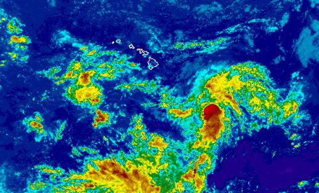
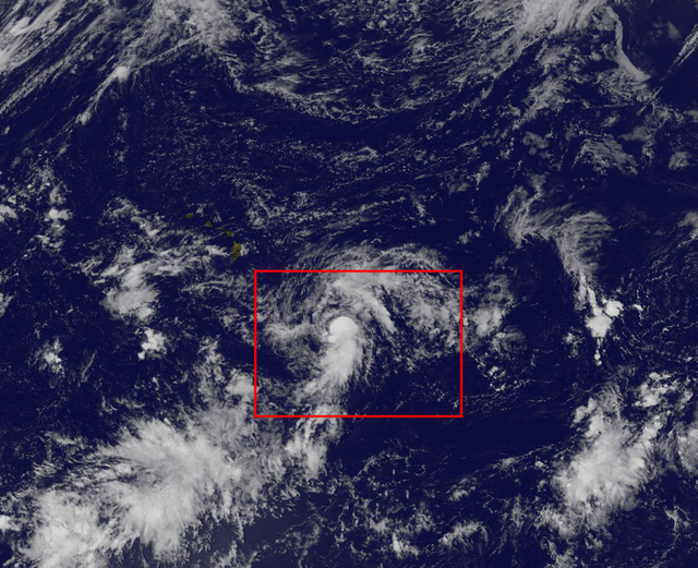
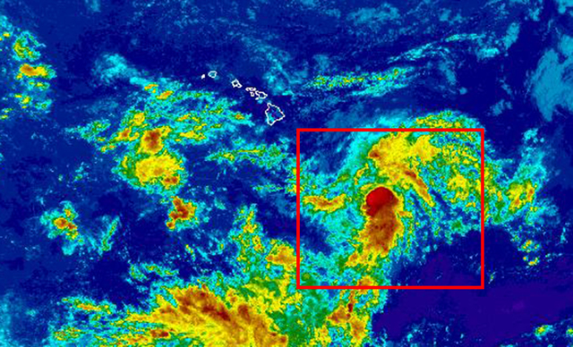
Flash flooding spurred by heavy rain is expected across the Big Island this weekend as a weather system that has been festering since early this week nears the state. Thunderstorm activity increased throughout Thursday as the disturbance, located about 575 miles southeast of Kailua-Kona, organized to form Tropical Depression 6-C. As of 5 p.m., the depression was circulating 35 mph winds and moving northwest at 8 mph over 82- to 84-degree waters.
“Even if it were not to develop, the Big Island would still be experiencing a rain threat. It really doesn’t matter what happens to this thing, the rain threat is still the same,” said Derek Wroe, a meteorologist with the National Weather Service in Honolulu. “Most likely, we are looking at Saturday night when we will start seeing conditions sort of ripe for flash flooding, especially for windward areas, and on the Kona side, more toward Sunday.”
Current forecast models show a short window for the storm to strengthen beyond a depression; however, the possibility remained that it could reach tropical storm strength Thursday night, at which point it would be named Niala. Wroe said it is “highly unlikely” a hurricane will form thanks to strong upper-level winds that are expected to weaken the storm to a depression by Sunday afternoon as it passes about a hundred miles south of the Big Island.
“It doesn’t matter what happens with this thing, the flood threat stays the same,” he stressed.
Inclement weather is expected to impact the Big Island through Monday. Wroe said Thursday afternoon that it was too early to estimate the extent of rainfall, but repeated the island needs to be prepared to again be sopped.
Since mid-August, leeward areas of the Big Island have seen heavy rainfall that has resulted in evacuations; rescues; flooded homes, businesses and properties; road closures; and damaged infrastructure. A flood advisory was posted Thursday afternoon, with forecasters reporting rain falling at a rate of 3 inches per hour in some areas between Kailua-Kona and Hawaiian Ocean View Estates in Ka‘u.
“The one thing we are confident about is the Big Island will be the most likely to experience the flooding threat,” Wroe said.
The depression’s formation was the 11th tropical cyclone within the Central Pacific basin, forecasters said.
The number ties the record for the most active season, which was set in 1992 and repeated in 1994. In 1992, Hurricane Iniki slammed into Kauai packing 140 mph winds.
Forecasters, at the start of the season, called for an above-normal season with five to eight tropical cyclones — a category that includes tropical depressions, tropical storms and hurricanes — expected to impact the basin this year. On average, the basin annually sees four or five tropical cyclones in its waters.
Elsewhere in the Central Pacific, no tropical cyclones are expected to develop through Saturday afternoon.
In the Eastern Pacific, forecasters are keeping tabs on two areas of low pressure off the coast of Guatemala and southwestern Mexico. A tropical depression is expected to form off southwestern Mexico by early next week. The weather system off Guatemala is not expected to develop into a tropical cyclone because of its proximity to land and the disturbance off southwestern Mexico.
The Central and Eastern Pacific hurricane seasons continue through Nov. 30.
Email Chelsea Jensen at cjensen@westhawaiitoday.com.


