The Island of Hawaii recently lived up to its worldwide reputation as a beautiful and dynamic place frequently vulnerable to many natural hazards. These include hurricanes, earthquakes, tsunamis, floods and wildfires, as well as eruptions that can send lava flows
The Island of Hawaii recently lived up to its worldwide reputation as a beautiful and dynamic place frequently vulnerable to many natural hazards. These include hurricanes, earthquakes, tsunamis, floods and wildfires, as well as eruptions that can send lava flows through communities and create widespread volcanic air pollution.
For the administrator and staff of Hawaii County Civil Defense, this list of potential hazards can be daunting. In each instance, they coordinate the county’s emergency preparedness and response programs to ensure quick, appropriate and effective action for public safety.
Add to this list the consequences of invasive species that affect public health — for example, the mosquitoes responsible for spreading dengue fever — and it’s evident why the Civil Defense team has been running full steam, and practically nonstop, on behalf of the public in recent years.
This past week was Darryl Oliveira’s last as the administrator of county Civil Defense, a position he has had since early 2013. He retires effective today (May 1).
Given the pace and intensity of natural events affecting the Big Island since taking the post, Darryl’s resilience and emphasis on community collaboration and preparedness clearly demonstrate he was the right person at the right time for our island.
On Hawaii Island’s two most active volcanoes, Kilauea and Mauna Loa, changes in activity are the norm. This means response planning and coordination by Hawaii County Civil Defense are never far around the corner, even when things look relatively quiet and steady.
When Darryl assumed leadership of Civil Defense, lava erupted from the Pu‘u ‘O‘o vent was spilling down Kilauea’s flank and being carried through a lava tube southward to the ocean, a distance of about 14 km (8.7 mi). With no homes in immediate danger, the volcanic activity was not too great a concern for Civil Defense. But then, Pu‘u ‘O‘o began to change.
Within two weeks of Darryl stepping into his new job, USGS Hawaiian Volcano Observatory geologists noted increased activity within the Pu‘u ‘O‘o crater, describing it as more vigorous than during the previous year. An overflow of the small lava pond on the northeast rim of the crater sent a fast-moving, but small, flow down the flank of the Pu‘u ‘O‘o cone in a northerly direction. This and subsequent flows became known as the Kahauale‘a I and II flows, which were cause for concern at the time, as they were spreading on the north side of Kilauea’s East Rift Zone.
This meant lava flows could eventually reach Puna District communities. In response to this change, Darryl, his Civil Defense staff and HVO scientists communicated regularly through 2013 and early 2014 about the hazards posed by the flow.
The possibility of lava impacting communities became real in August 2014, when a new flow, informally called the June 27 lava flow, traveled faster and farther to the east from Pu‘u ‘O‘o and into a series of deep ground cracks along the crest of Kilauea’s East Rift Zone.
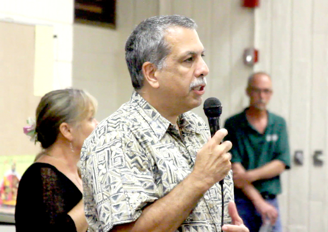
As soon as it became clear the June 27 lava flow could potentially move through Puna communities and cross Highway 130, the Hawaii County Mayor’s Office quickly organized the first of nearly two dozen public meetings hosted between August 2014 and March 2015. These well-attended meetings became a popular forum for Darryl, his staff, other county leaders and HVO scientists to discuss the flow’s progress, potential impacts and evolving response plans with Puna residents and businesses, as well as with the Red Cross and other emergency responders, nongovernment agencies, media and elected officials.
During those months, HVO greatly appreciated Darryl’s calm, collaborative and tireless spirit in sustaining the framework needed to help island residents cope with the June 27 lava flow.
For the never-ending readiness of Civil Defense to respond to the 2014-15 lava flow and the many other natural events before and after it, we say mahalo nui loa, Darryl! We wish you all the best in your retirement.
Volcano activity update
Kilauea continues to erupt at its summit and East Rift Zone. During the past week, the summit lava lake level varied between about 31.5 and 39 m (103 and 128 ft) below the vent rim within Halema‘uma‘u Crater. On the East Rift Zone, scattered lava flow activity remained within about 5.7 km (3.5 mi) northeast of Pu‘u ‘O‘o and was not threatening nearby communities.
Mauna Loa is not erupting. Seismicity remains elevated above long-term background levels, but no significant changes were recorded during the past week. Deformation data show continued inflation of a magma reservoir beneath the summit and upper Southwest Rift Zone of Mauna Loa, with inflation recently occurring mainly in the southwestern part of the magma storage complex.
One earthquake was reported felt on the Island of Hawaii in the past week. At 10:05 p.m. April 23, a magnitude-3.2 earthquake occurred 3.1 km (1.9 mi) southwest of Kilauea Summit at a depth of 2.6 km (1.6 mi).
Visit the HVO website (http://hvo.wr.usgs.gov) for past Volcano Watch articles, Kilauea daily eruption updates, Mauna Loa weekly updates, volcano photos, recent earthquakes info, and more; call for summary updates at 808-967-8862 (Kilauea) or 808-967-8866 (Mauna Loa); email questions to askHVO@usgs.gov.
Volcano Watch (http://hvo.wr.usgs.gov/volcanowatch/) is a weekly article and activity update written by scientists at the U.S. Geological Survey`s Hawaiian Volcano Observatory.


