Travel the shorelines of Hawaii and you’ll find corals, seashells and driftwood washed in from the sea.
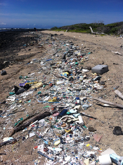
You’ll also find plenty of trash.
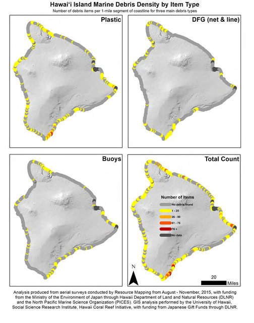
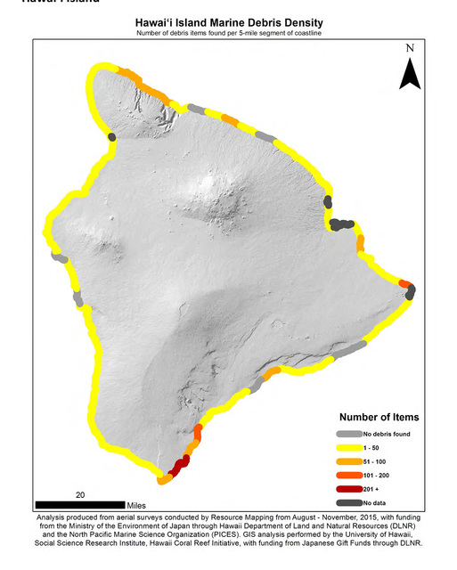
Results from an aerial mapping survey conducted last summer by a group of agencies including the National Oceanic and Atmospheric Association, the state Department of Land and Natural Resources and the North Pacific Marine Science Organization will help better manage cleanup and mitigation efforts.
“In order to characterize the potential ecological consequences of tsunami and other debris, it’s important to quantify it,” DLNR Marine Debris Coordinator Kirsten Moy said in a statement.
On Hawaii Island, 2,200 pieces of marine debris were mapped during the August to November 2015 time period. Fifty-two percent of that was plastic. Most was concentrated at Kamilo Point in Ka‘u.
The survey was funded by the Ministry of the Environment of Japan as part of the Japan Tsunami Gift Fund that was awarded to West Coast states and Hawaii as clean-up efforts began after the devastating March 2011 tsunami.
Marine debris from the tsunami first started appearing on Hawaii shores in 2012 and continues to circulate in the Pacific.
Although debris from the natural disaster is well-studied, most of the debris mapped during the aerial survey is not tsunami-related.
“Most of what was mapped is common, everyday items that someone haphazardly tossed onto the ground or directly into the water,” DLNR chairwoman Suzanne Case said in a release.
That’s not surprising, said Nikolai Maximenko, a senior researcher at the University of Hawaii’s International Pacific Research Center.
Maximenko and IPRC scientific computer programmer Jan Hefner created models mapping how tsunami debris would behave as it was carried around the Pacific currents.
“According to the Japanese government, the tsunami released approximately 1.5 million tons of floating debris,” he said. But the best estimate for how much debris is produced in the Pacific region annually is about 2 million tons.
“In terms of amounts, what is floating in the ocean … exceeds the amount that came from the tsunami,” Maximenko said.
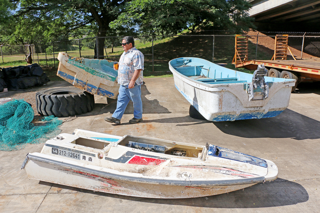
Tsunami debris tends to be large, such as fishing boats or fish boxes. One fish box was found last Friday during a Hawaii Wildlife Fund beach cleanup at Kamilo Point.
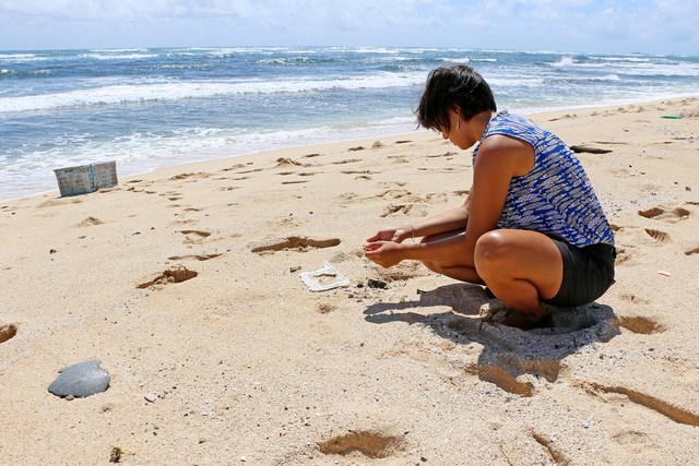
A group of college students visiting from Florida filled 48 bags of trash that day and removed about 1,525 pounds of debris, said Megan Lamson, HWF vice president and coordinator of the Hawaii Island Marine Debris Removal Project. She said aside from the fish box, most of what was taken away was “little small plastic objects.”
“A lot of it is just unidentifiable,” Lamson said.
Other times, it’s bizarre.
On Friday, for example, the group found three plastic piggy banks.
“We’ve never seen them before,” Lamson said.
The aerial survey found 85 percent of the Hawaii Island debris fell into the “very small” classification: less than 0.5 of a square meter.
Kamilo Point, on the southeast shore of Ka‘u, is a hot spot of debris accumulation — and an unusual one at that: Data indicate most shorelines that collect trash are on an island’s northeast side thanks to how currents circulate.
Ocean current behavior was cited in the survey as one reason why Niihau had the most debris counted: 7,871 pieces, or 38 percent of the total recorded.
Maximenko suggested other factors contributed to the high debris count.
“I think it’s not only about currents,” he said. “It’s partly because the island was never cleaned.” Niihau, with its small population and lack of nonresident access, does not have the same resources to address accumulating debris as other islands.
Moy posited that more frequent cleaning by conservation groups was one reason Oahu had the least density of debris: just 5 percent of the total mapped.
Maui-based HWF typically organizes 20 beach cleanups a year on Hawaii Island. Its first cleanup in 2003, funded by a state grant, brought in 100,000 pounds of debris. Most of that was large fishing nets that washed ashore and were buried in the sand.
Mapping efforts allow groups to get a better sense for which places to address and what to remove. Fishing nets now can be taken away shortly after they wash up.
Given that millions of tons of trash and debris enter the Pacific each year, Lamson said some consider beach cleanups a Band-Aid of sorts. But the efforts “definitely” make a difference, she said.
“We’re preventing a bunch of interactions with marine wildlife, and it’s a great educational outreach tool,” she said. “You bring someone down there (to a remote area), and they don’t see any other evidence of humanity there, and yet there’s thousands of pounds of debris and plastic.”
Email Ivy Ashe at iashe@hawaiitribune-herald.com.


