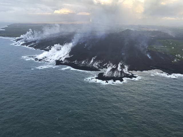
The Kilauea eruption in Puna continues to reshape the coastline after devouring Kapoho Bay and most of its neighboring homes.
The Kilauea eruption in Puna continues to reshape the coastline after devouring Kapoho Bay and most of its neighboring homes.
About 200 acres of new land has been created since a lava flow tore through Vacationland and Kapoho Beach Lots and began entering the ocean last week.
A large plume of smoke and gas from the ocean entry could be seen in Pahoa on Saturday and elsewhere in East Hawaii.
About 600 homes have been destroyed so far since the lower East Rift Zone eruption began May 3, most of them in Kapoho.
The active event, known as fissure No. 8, in Leilani Estates was fountaining lava up to 200 feet in the air Saturday and continued to feed a long channelized flow into the sea.
Janet Babb, Hawaiian Volcano Observatory spokeswoman, said the fissure has built up a cone 115 feet tall on its southwest side.
Another eruption at Kilauea’s summit inside Hawaii Volcanoes National Park sent a small ash plume up to 10,000 feet above sea level Saturday morning. The park remains closed.
The throat of the volcano remains clogged with debris and these explosive events are occurring regularly every 24 to 48 hours. More minor eruptive events are occurring in between.
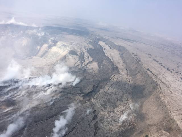
Babb said one part of the Halema‘uma‘u crater had subsided nearly 80 feet at one location. She emphasized that measurement is localized and doesn’t reflect the extent of subsidence elsewhere.
She said more instruments are being installed in the caldera to better track subsidence rates. The caldera is dropping in response to withdrawal of lava from the summit.
The subsidence is causing one edge of Halema‘uma‘u crater to slump inward.
Email Tom Callis at tcallis@hawaiitribune-herald.com.

Subscribe today for unlimited access.
Already a subscriber?
Login
Not ready to subscribe?
Register for limited access.
If you have a print subscription but require digital access,
activate your account.


