Continuous seismic activity at Kilauea has led state and county road crews to monitor a stretch of Highway 11 for signs of deterioration.
As hundreds of tremors shake Hawaii Volcanoes National Park, the surface of Highway 11 passing through the park has developed several cracks.
Janet Snyder, spokeswoman for Mayor Harry Kim, said Monday that road crews are watching the condition of the road between mile marker 28.5 at the entrance to the park and mile marker 31.7 past Namakanipaio campground very closely.
“They’re going to be doing highway repair work, for sure, at some point,” Snyder said.
Parks spokeswoman Jessica Ferracane said Monday that police would be on site monitoring the road’s surface and enforcing a 25 mph speed limit. For the time being, drivers are asked to drive slowly and carefully through the area.
Hawaiian Volcano Observatory geologist Janet Babb said Monday that the summit has experienced more than 4,500 quakes in the past week. Summit collapse explosions occur regularly, releasing energy equivalent to magnitude-5 earthquakes or greater.
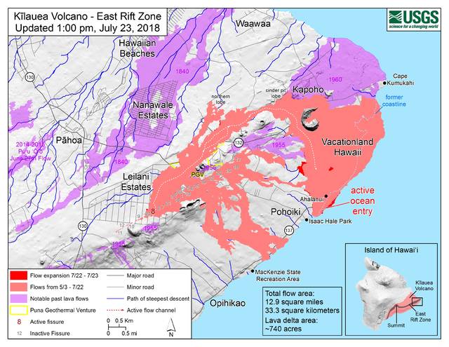
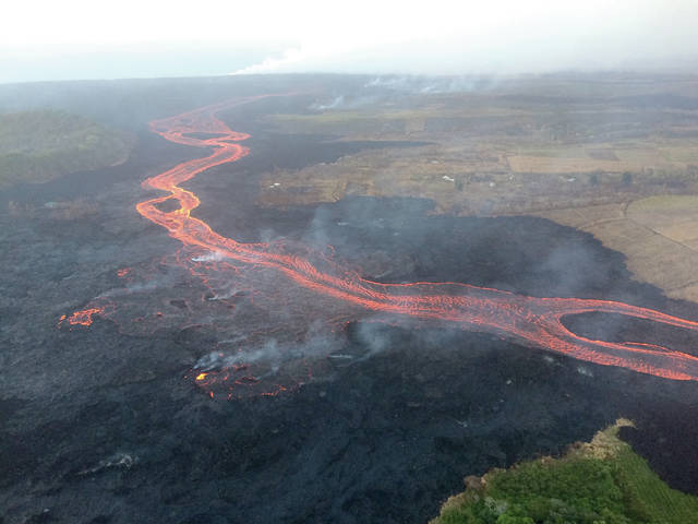
In the lower East Rift Zone, the lava flow from fissure 8 continues to enter the ocean mostly near Ahalanui, said Babb. The southern edge of the flow front remains approximately 0.3 miles away from Isaac Hale Beach Park and has not moved significantly for several days, she said.
While a disruption in the regular trade winds caused emissions from the lower East Rift Zone to be blown upslope toward the Saddle region Monday, National Weather Service forecaster Derek Wroe said the wind patterns likely will return to normal for the remainder of the week.
The official count of destroyed homes remains at 712.
As of Sunday, there were 133 evacuees staying at the Pahoa shelter and 35 staying in the Keaau shelter.
The Disaster Recovery Center at Keaau High School remains open six days a week from 8 a.m.-6 p.m. weekdays and 8 a.m.-4 p.m. Saturdays.
Email Michael Brestovansky at mbrestovansky@hawaiitribune-herald.com.


