“If you have outdoor plans for the weekend, be prepared for very windy conditions. If your plans include marine activities, you may want to consider postponing them.”
That warning is part of a special weather statement issued by the National Weather Service in Honolulu. A low pressure system described as “an unusually strong storm system” is forecast to bring multiple weather hazards during the weekend, forecasters cautioned.
“The storm will send a powerful swell toward the islands that will impact exposed north- and west-facing shores with very high surf,” the weather statement cautioned. “Additionally, the combination of strong onshore winds and high surf will increase the potential for significant coastal flooding that could lead to property damage, road closures and beach erosion.”
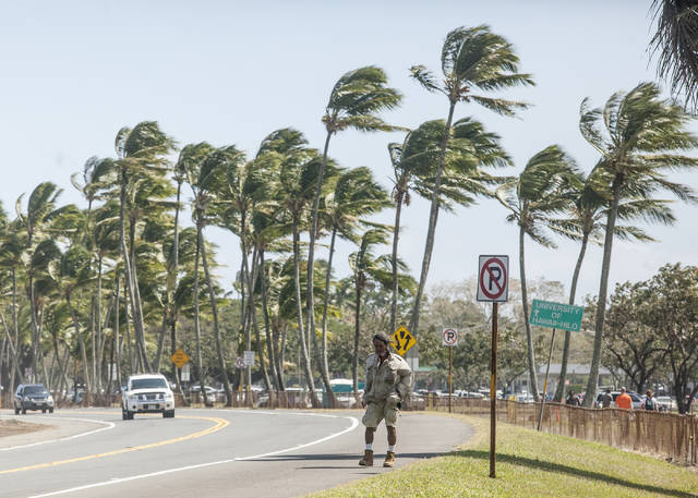
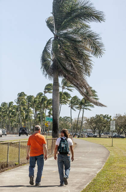
Forecasters also warned of “potentially damaging north to northwest winds to the island chain, particularly Saturday night through Sunday evening.”
“The Big Island will see some impacts,” said Vanessa Almanza, a forecaster at the National Weather Service in Honolulu, late Friday afternoon. “You can anticipate as the storm gets closer, the winds will start picking up for Hilo and Kona.”
At 4 p.m. Friday, sustained winds at Hilo International Airport were 22 mph with gusts of more than 30 mph. Similar wind speeds were recorded from the northwest at Ellison Onizuka Kona International Airport at Keahole in Kona.
Scattered showers also are in the weekend forecast.
Almanza said Big Islanders should be prepared for “north winds increasing to at least 20 to 30 miles per hour in some areas with gusts over 50” mph.
A wind advisory is in effect until 6 p.m. today, and forecasters are anticipating the issuance of a high wind watch at 6 p.m. tonight until 6 p.m. Monday.
A high wind watch signifies the potential for a hazardous wind event. Sustained winds of at least 40 mph or gusts of 58 mph or stronger could occur.
“Winds this strong can make driving hazardous, can cause minor localized damage and result in power outages,” the written statement said. “Continue to monitor the latest forecasts, secure loose objects and prepare for the possibility of power outages.”
A high wind warning was issued for the summits and upper slopes of Maunakea and Mauna Loa until 6 p.m. Sunday.
Sustained winds of 75-85 mph are possible this weekend, with gusts of 100 to 115 mph, forecasters said. Sustained winds of more than 56 mph or gusts of more than 66 mph are possible at the summits Sunday night and Monday.
Maunakea Access Road was still open as of 5 p.m. Friday.
The state Department of Land and Natural Resources issued a statement advising all boaters with craft in state small boat harbors or using off-shore moorings to secure their vessels well in advance of the storm. DLNR also cautioned campers and others using facilities along the coastline “to move out of harm’s way if necessary.”
“This could be a powerful storm, and along with all of our federal, state and county partners, we can’t stress strongly enough that anyone living or playing along coastlines should pay attention to the latest weather advisories and warnings to be sure they stay safe,” said DLNR Chairwoman Suzanne Case.
The City and County of Honolulu had a press conference Friday afternoon to warn residents and express concerns, saying waves could enter beachfront houses on the island’s North Shore and advising people to be flexible with their travel plans and to not “put yourselves and our first responders in harm’s way.”
Hawaii County Civil Defense issued its first radio message about the approaching storm at 2 p.m. Friday.
“Residents and beachgoers are advised to stay alert for dangerous ocean and wind conditions,” said Talmadge Magno, county Civil Defense administrator. “… Conditions will be monitored islandwide, and you will be kept informed of changes that may affect your safety.”
Added Almanza, “We want to give the public notice of the potential of what this storm can do. This can be high impact with the wind and the surf.”
Email John Burnett at jburnett@hawaiitribune-herald.com.