Sacred Heart Church in Pahoa was packed Saturday for a discussion about a small boat ramp in lower Puna.
A large crowd gathered at the church, where community members heard from a handful of individuals about a recent engineering study commissioned by the state Department of Land and Natural Resources Division of Boating and Ocean Recreation that evaluated the possibility of reopening the now land-locked Pohoiki boat ramp or opening a ramp at a different site.
One spoke out against the alternative site evaluated in the study and others recommended potential boat ramp sites near the existing facilities at Pohoiki.
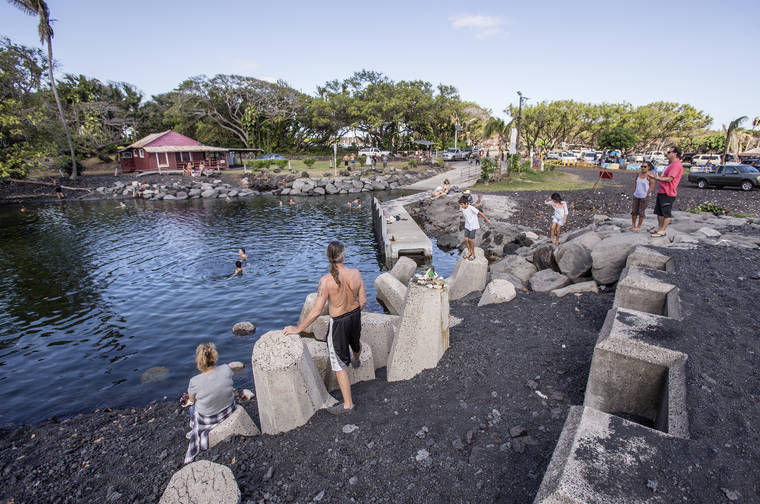
The only boat ramp between Hilo and Milolii, the Pohoiki ramp closed shortly after Kilauea began erupting in May 2018 and eventually became landlocked by what is now a 200-foot-wide black sand and cobblestone beach.
While it’s technically possible to remove sand and create a channel to the Pohoiki ramp, the engineering study, which was released in June, found that effort would be expensive and full of uncertainties associated with sand movement and coastal processes continuing in and around Pohoiki Bay.
The alternate site evaluated in the study, Malama Flats, is located just south of MacKenzie State Recreation Area and “appears to offer reasonable conditions for design of an inland excavated ramp facility, however no quantitative site information is presently available,” the engineer’s report stated.
Sea Engineering estimates it would cost approximately $37.9 million to restore the existing Pohoiki ramp, while the estimated cost for a new ramp at Malama Flats is $14.5 million.
“Today is not a day to come up and for us to tell you what the solution is because the solution is going to be the product of all the interest groups represented here, coming together,” Bob Masuda, first deputy director of the state Department of Land and Natural Resources told the gathered crowd.
In terms of the engineering report, Masuda said DLNR “needed to do a quick, down and dirty thing to find out what’s cooking, what is a challenge, and that’s what this is. This is not an engineering report that is telling us exactly what to do, it’s telling us what is there as a result of what happened.”
For commercial fishermen and those who “stay alive because of the recreation fishing,” Masuda said not having a ramp is “pretty severe.”
Commercial operator Michael Trask, a fisherman since 1980, said he spent most of his fishing career on the east side of Hawaii Island and primarily out of Pohoiki.
He said Pohoiki was given to the county and state by the family that had owned the land, and was always meant for fishermen.
“ … In looking what’s happened to the ramp over there, I got to tell you guys that when you look at the lava flow, that flow stopped three feet from the parking lot on the north side and stopped just a little ways on the south side,” he said. “That whole place was spared. And in my heart, I know that’s because Uncle gave that place so fishermen can fish. Period. And I think that’s why that place was spared.”
In his opinion, Trask said the only place a new ramp can go is just a few hundred yards above the existing ramp.
“Because No. 1, there’s no archaeological sites that you guys got to worry about, big fights coming up. No. 2, nobody owns it, it’s state land. No. 3, got water and electricity right there. … My solution, and I think for most of the fishermen is No. 1, get us in the water. Not five years from now, I’m thinking like six months at the most.”
Others, including Hawaii Tracker’s Dane DuPont and Philip Ong, also suggested alternative sites near Pohoiki, north of the existing boat ramp on the new lava flows.
Leila Kealoha, a fisherwoman and president of Puna nonprofit organization KAPONO, through which Na Lau‘o O Ka‘akepa was formed, addressed the alternate site evaluated in the DLNR study, also known as Ka‘akepa.
“Our committee does not accept the proposed desecration or development of Ka‘akepa,” she said. “This area has archaeological and cultural sites such as burials and the Ala Loa, or The King’s Trail. … The very thoughts of proposing this site goes against the traditional and customary practices and native tenants rights of our people. These practices and rights are traditionally cultivated amongst our people and this is one of the last places we are able to continue to pass them down to future generations. This area is very prone to volcanic activity and is recorded in chants and hula dating back over 1,000 years. The people that are familiar with Puna coastline agree that the proposed ramp at Ka‘akepa will not be accepted.”
That’s why Na Lau‘o O Ka‘akepa was formed, “to protect that place,” she said by phone Monday.
Puna state Rep. Joy San Buenaventura, who hosted the informational meeting, said by phone Monday that DLNR committed to visiting the sites proposed Saturday to determine whether or not the area is promising for a new boat ramp.
At the same time, she said the state needs to continue to pursue Federal Emergency Management Agency reimbursements.
The state Legislature approved $500,000 this session for planning and design for a new boat ramp.
The June engineering study and report cost $40,000, which San Buenaventura said came from $250,000 initially allocated for boat ramp repairs in 2017.
San Buenaventura said she hasn’t heard “anything negative” about the proposed site and that the only negative could be if it would affect surfers or swimmers.
“But the fishermen need to recover first, then we’ll find a swimming area second if it in any way affects them,” she said.
Email Stephanie Salmons at ssalmons@hawaiitribune-herald.com.


