The mission of the U.S. Geological Survey’s Hawaiian Volcano Observatory (HVO) is “to monitor, investigate, and assess hazards from active volcanoes and earthquakes in Hawaii, and communicate results of this work to the public, emergency managers, and scientific community.”
Whether this work is done during a volcanic crisis (such as in 2018), or during the COVID-19 pandemic (when HVO staff work remotely from home), HVO is on the job, 24/7.
Because HVO has over 100 years of volcano monitoring experience, scientists from volcano observatories around the world are eager to visit and learn from HVO and our active volcanoes. During Bob Decker’s tenure as HVO Scientist-in-Charge (1979–1984), he hosted many scientists from international observatories, such as Indonesia, to “shadow” HVO staff and learn modern monitoring techniques.
The occasional request for shadowing and training became a flood in 1985 after a small eruption of the Colombian volcano, Nevado del Ruiz, produced debris flows that tragically killed more than 23,000 residents living at the foot of the volcano.
To meet the need for training, Dr. Decker, who by then was a geology faculty member at the University of Hawaii at Hilo campus, came up with a brilliant plan: UH-Hilo would host an International Training Program in Volcano Monitoring Methods. This would provide scientists from developing countries, such as Indonesia, Papua New Guinea, and Guatemala, with training in how the USGS monitors volcanoes.
Thus, the Center for the Study of Active Volcanoes, or CSAV, was established at UH-Hilo. CSAV is a partnership among UH-Hilo, the Hawaii Institute of Geophysics and Planetology at the UH-Manoa campus, and HVO.
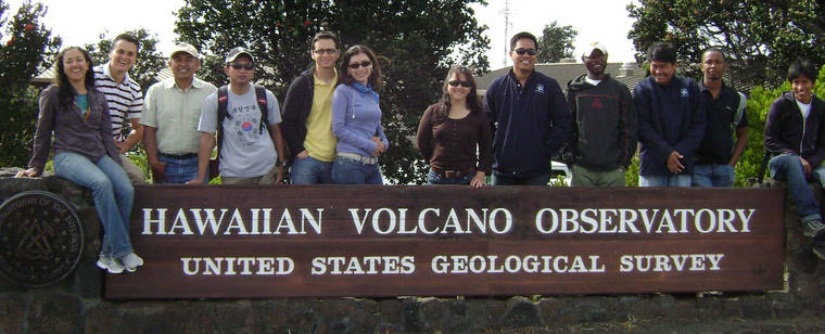
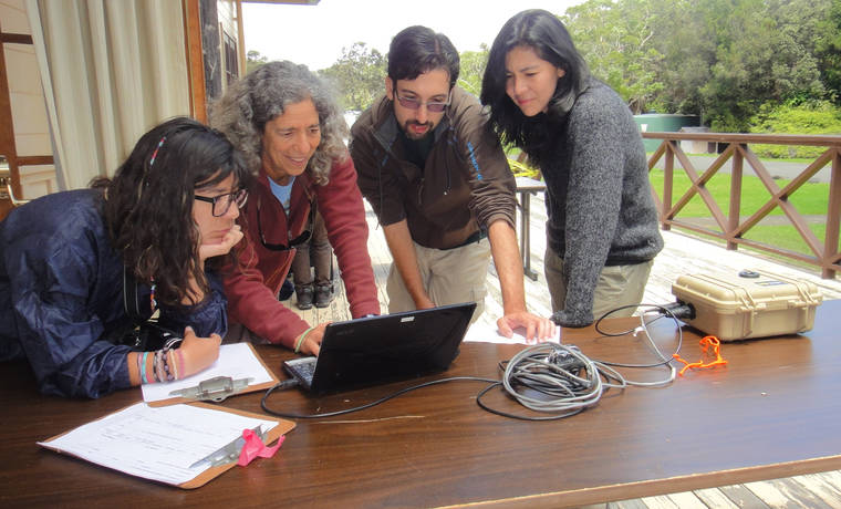
Since 1990, CSAV has offered an annual six- to eight-week summer training course for international volcanologists. UH-Hilo organizes course logistics, from airline flights to housing to schedule. HVO staff, as well as scientists from other USGS observatories and UH, provide instruction and hands-on training in geophysical, geochemical, and geological methods of monitoring and assessing volcano hazards. Training is also provided on how to best communicate those hazards to civil officials and the public.
Six weeks of the course are in Hilo and two weeks are at Cascades Volcano Observatory, where trainees have an opportunity to learn about more explosive volcanoes than we have here in Hawaii.
Scientists who attend the training program return to their home countries better equipped to gather and interpret monitoring and other data, and to communicate effectively.
Compared with Hawaiian volcanoes, volcanoes of Peru, El Salvador, and the Philippines are far more dangerous, and are surrounded by cities with millions of people who are at risk. Hence, the CSAV program is not merely educational, but is designed to save lives by empowering developing nations to be self-sufficient in monitoring and forecasting eruptions.
In addition to the International Program, HVO and CSAV have had a formal Cooperative Agreement in place for more than two decades. This agreement allows USGS funds to hire technical support staff (and UH-Hilo students) who assist HVO in monitoring and research and to acquire scientific equipment used by both HVO and UH-Hilo earth scientists. This relationship has had many benefits for both USGS and UH. As an example, a number of UH-Hilo’s students and staff worked long hours during the 2018 eruption crisis to help alleviate the tremendous demands made on the HVO staff by that event.
The HVO-CSAV Cooperative Agreement also provides funding to augment HVO’s public outreach efforts. A CSAV education specialist, funded by the agreement, visits Big Island schools to talk to students about volcano and other natural hazards on the island.
These school visits are extremely popular and feature hands-on demonstrations where children try on the field gear worn by volcanologists, make a miniature tsunami, and create their own “earthquake.” This program also provides students with informational handouts to take home to their parents and help the entire family be better prepared for our natural hazard events.
As with the threat to our community posed by the COVID-19 pandemic, the key to successfully managing volcano hazards requires cooperation and work by many individuals and organizations, as well as awareness, preparedness, and adaptability by our entire community. Please keep informed, stay safe, and stay healthy.
Learn more about CSAV at https://hilo.hawaii.edu/csav/.
Volcano
activity updates
Kilauea Volcano is not erupting. Its USGS Volcano Alert level remains at NORMAL (https://volcanoes.usgs.gov/vhp/about_alerts.html). Kilauea updates are issued monthly.
Kilauea monitoring data for the past month show variable but typical rates of seismicity and ground deformation, low rates of sulfur dioxide emissions, and only minor geologic changes since the end of eruptive activity in September 2018. The water lake at the bottom of Halema‘uma‘u continues to slowly expand and deepen. For the most current information on the lake, see https://volcanoes.usgs.gov/volcanoes/kilauea/summit_water_resources.html
Mauna Loa is not erupting and remains at Volcano Alert Level ADVISORY. This alert level does not mean that an eruption is imminent or that progression to eruption from current level of unrest is certain. Mauna Loa updates are issued weekly.
This past week, about 62 small-magnitude earthquakes were recorded beneath the upper elevations of Mauna Loa; most of these occurred at shallow depths less than 8 kilometers (~5 miles). Global Positioning System measurements show continued slow summit inflation, consistent with ongoing magma supply to the volcano’s shallow storage system. Gas concentrations at the Sulphur Cone monitoring site on the Southwest Rift Zone remain stable. Fumarole temperatures as measured at both Sulphur Cone and the summit have not changed significantly. For more information on current monitoring of Mauna Loa Volcano, see: https://volcanoes.usgs.gov/volcanoes/mauna_loa/monitoring_summary.html
There were 4 events with 3 or more felt reports in the Hawaiian islands during the past week: a magnitude-3.7 earthquake 25 km (16 mi) W of Kailua-Kona at 41 km (25 mi) depth on May 6 at 10:55 p.m. HST, a magnitude-3.9 earthquake 18 km (11 mi) S of Hawaiian Ocean View at 35 km (22 mi) depth on May 5 at 03:22 p.m. HST, a magnitude-3.1 earthquake 6 km (4 mi) ENE of Pahala at 33 km (21 mi) depth on May 4 at 1:50 a.m. HST, and a magnitude-3.2 earthquake 7 km (4 mi) ENE of Pahala at 32 km (20 mi) depth on May 4 at 01:46 a.m. HST.
HVO continues to closely monitor both Kilauea and Mauna Loa.
Please visit HVO’s website for past Volcano Watch articles,for past Volcano Watch articles, Kilauea and Mauna Loa updates, volcano photos, maps, recent earthquake info, and more. Email questions to askHVO@usgs.gov.
Volcano Watch is a weekly article and activity update written by U.S. Geological Survey Hawaiian Volcano Observatory scientists and affiliates. Today’s article is by Center for the Study of Active Volcanoes educational specialist Darcy Bevens and Center for the Study of Active Volcanoes director Don Thomas.


