60% chance of El Nino weather conditions predicted for the fall

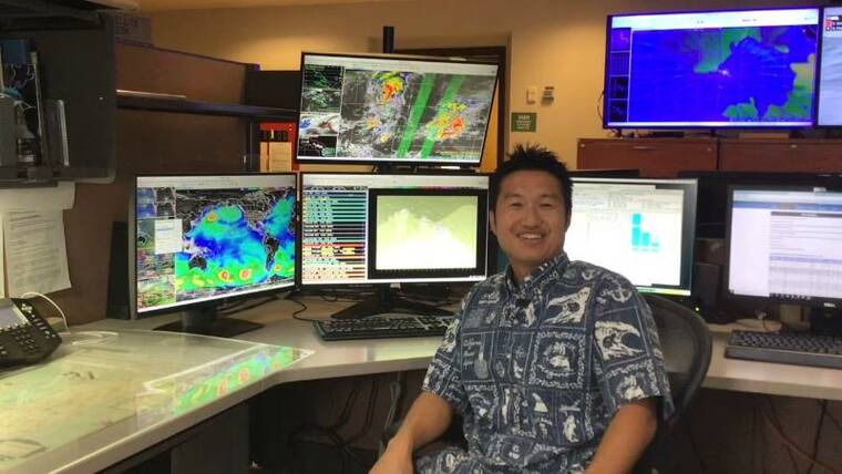
Genki Kino is a meteorologist for the National Weather Service n Honolulu.

Kelsey Walling/Tribune-Herald Li Jack and Eliana swim together in Onekahakaha Beach Park on Thursday in Keaukaha.
La Nina is over, and weather patterns have returned to what forecasters call ENSO-neutral, the National Oceanic and Atmospheric Administration said Thursday.
La Nina is over, and weather patterns have returned to what forecasters call ENSO-neutral, the National Oceanic and Atmospheric Administration said Thursday.
That’s after a rare three consecutive La Nina years.
ADVERTISING
La Nina is a natural and temporary cooling of parts of the Pacific Ocean that changes weather worldwide. La Nina also has slightly dampened global average temperatures, preventing the heat from breaking records, while El Nino slightly turbocharges those temperatures, often setting heat records, scientists said.
NOAA’s Climate Prediction Center in College Park, Md., is predicting ENSO-neutral conditions — neither La Nina nor El Nino — at least through midsummer, but with a 60% chance of El Nino conditions developing in August, September or October.
“El Nino years are typically the years we have an above average number of tropical cyclones in the Central Pacific,” said Genki Kino, a meteorologist for the National Weather Service and Central Pacific Hurricane Center in Honolulu. “The record year was 2015. That was a strong El Nino year.
“In the 2015 hurricane season, there were 16 tropical cyclones in the Central Pacific basin — the most active year in the Central Pacific — but none of those cyclones impacted land.”
Hurricane season is June through November in Hawaii.
El Nino winters are different than El Nino summers, Kino said.
“During El Nino winters, we typically see drier conditions here,” he explained. “We also see lighter winds and larger surf. La Nina years are usually windier, rainier and with smaller surf.”
Both El Nino and La Nina have, basically, an opposite effect in the continental U.S. and the Atlantic Coast than they have on Hawaii.
La Nina is connected to more Atlantic storms and deeper droughts and wildfires in the western U.S. La Ninas often are more damaging and expensive than El Ninos.
“This is the weird thing. El Nino years are normally the years (the western U.S.) get big snowfall and all the storms. But they’ve been getting it this year,” Kino said. “So that doesn’t really match climate signals — but the usual climate signals aren’t always going to match up. It is unusual, though, that this is the year they’ve been getting a record snow pack on a La Nina winter.”
Generally, American agriculture is more damaged by La Nina than El Nino. If the globe jumps into El Nino, it means more rain for the Midwestern corn belt and could be beneficial, said Michael Ferrari, chief scientific officer of Climate Alpha, a firm that advises investors on financial decisions based on climate.
Over the last three years, the mainland U.S. has been hit by 14 hurricanes and tropical storms that caused $1 billion or more in damage, totalling $252 billion in costs, according to NOAA economist and meteorologist Adam Smith. La Nina and people building in harm’s way were factors, he said.
Mere days before the announcement that La Nina had given way to ENSO-neutral conditions, the windward Big Island experienced one of its wettest Februaries on record.
Glenwood, Mountain View and Piihonua recorded record rainfall totals, with 54.49 inches, 51.44 inches and 45.77 inches, respectively, according to Kevin Kodama, NWS Honolulu’s senior service hydrologist.
After a January in which only 2.06 inches of rain fell at Hilo International Airport, the gauge there tallied 37.95 inches for February, its fifth wettest February on record. The February record occurred in 1979, with 45.55 inches.
For the Hilo airport, Pahoa and Waiakea Uka, it was the wettest February since 2008, with the latter two locations receiving 27.38 inches and 43.04 inches, respectively.
“This last month was definitely counter to El Nino,” Kino said.
This particular La Nina, which started in September 2020 but is considered three years old because it affected three different winters, was unusual and one of the longest on record. It took a brief break in 2021 but came roaring back with record intensity.
The forecast for Hilo on the National Weather Service website calls for mostly sunny weather through the weekend — signaling what should be, for most, a welcome return to ENSO-neutral conditions.
“We’re excited to see La Nina end,” Kino said. “El Ninos aren’t good for tropical cyclones, but at least the winters are drier with lighter winds.”
The Associated Press contributed to this story.
Email John Burnett at jburnett@hawaiitribune-herald.com.


