Volcano Watch: HVO’s mission depends on reliable and secure IT solutions
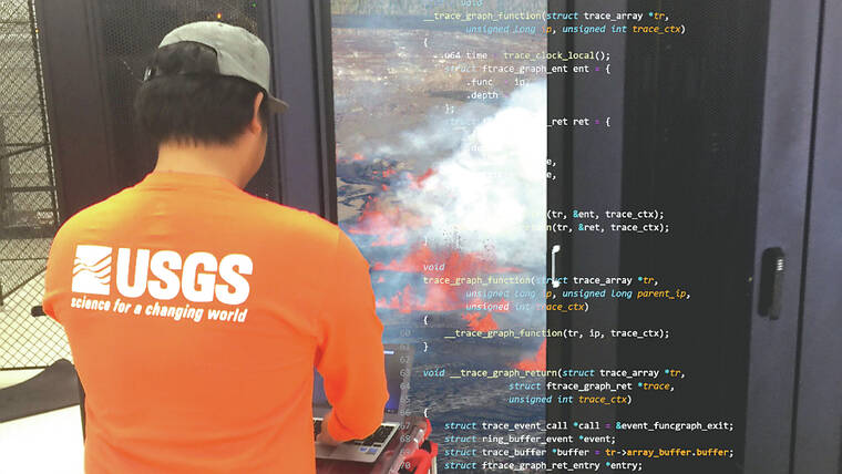
The USGS Hawaiian Volcano Observatory (HVO) is responsible for monitoring and studying one of the most active volcanic regions in the world. The observatory’s mission includes conducting research, providing scientific data to government agencies, and educating the public about volcanic hazards. In this unique environment, HVO’s information technology (IT) personnel play a critical role in supporting these goals while also adapting to ever-changing demands of scientific efforts and evolving federal regulations.
One of the primary duties of IT personnel at HVO is supporting existing and emerging volcano monitoring and science goals. The observatory uses a variety of instruments to collect data on volcanic activity — including seismometers, gas analyzers, ground deformation sensors and cameras. These data are then analyzed by scientists to understand the behavior of the volcanoes and forecast potential future activity.
ADVERTISING
HVO IT personnel work behind the screens, so to speak, leveraging computing and network assets to process and manage sizable amounts of data, ensuring that it can be accessed quickly and is stored securely. As the observatory’s needs evolve, so too does their response.
Additionally, HVO’s IT personnel are tasked with meeting evolving demands of federal regulations regarding security and integrity of systems. The observatory must adhere to strict guidelines for protecting sensitive information, maintaining the confidentiality, integrity and availability of its mission-critical systems. This requires a robust IT infrastructure that meets or exceeds regulatory requirements and a team that can withstand and respond to an array of potential challenges and issues.
HVO uses localized computing resources due to the disparate nature of instrument deployments and the remote location of the observatory. The volcanoes in its purview are spread across a wide geographic area, making it challenging to establish reliable communication links between instruments, the observatory and the central data processing facilities. Furthermore, the remote locations of most instruments make internet-facing links economically infeasible or impossible — and, in turn, renders cloud-based options impractical for many processing and analysis goals.
In order to overcome the challenges of distributed data gathering, we compute closer to the data source. This allows for local storage and analysis of data, minimizing the risk of external service outages affecting HVO’s mission. Efforts by HVO IT personnel to make these systems highly available reduce the risk of data loss or corruption during eruptions or other anomalous events. HVO’s infrastructure includes high-performance servers, storage systems and networking equipment that are designed to operate reliably in a remote location with limited access to external support.
Future-proofing is another essential consideration for HVO’s IT infrastructure. The observatory must ensure that its systems can adapt to new technologies and changing requirements while minimizing costs. To this end, HVO invests in training programs for its IT personnel and judiciously upgrades existing hardware and software systems. HVO IT personnel have developed custom software solutions to manage data collection and analysis, reducing reliance on costly commercial products. Similarly, custom solutions have been developed to meet emerging regulatory requirements. These solutions have also been made available to benefit other USGS observatories, science centers and offices, increasing the value provided via public funds.
The next time that you are on the HVO website to check the location of an earthquake, view a webcam image, or see how the ground is deforming, you can appreciate the high-quality IT infrastructure and exceptional personnel that are indispensable in supporting HVO’s mission. By maintaining reliable and secure systems for managing vast amounts of data, meeting regulatory requirements, ensuring local computing capabilities and future-proofing on limited budgets, HVO can continue to provide timely scientific information about volcanic eruptions and other natural processes that shape the region’s landscape.
Volcano activity updates
Kilauea is not erupting. Its USGS Volcano Alert level is ADVISORY.
Unrest that began on April 27 continues intermittently beneath the upper East Rift Zone and the summit caldera south of Halema‘uma‘u. There were less than 100 events most days over the past week except May 17-18, during which there were about 500 earthquakes. Most magnitudes remain smaller than 2 and depths remain concentrated between 2-4 km (1.2-3.1 miles) beneath the surface. Tiltmeters near Sand Hill and Uekahuna bluff continued to record inflationary trends. Kilauea’s summit region is pressurized, and changes could occur quickly moving forward.
Mauna Loa is not erupting. Its USGS Volcano Alert Level is at NORMAL.
Webcams show no signs of activity on Mauna Loa. Summit seismicity has remained at low levels over the past month. Ground deformation indicates continuing slow inflation as magma replenishes the reservoir system following the 2022 eruption. SO2 emission rates are at background levels.
Two earthquakes were reported felt in the Hawaiian Islands during the past week: a M3.4 earthquake 10 km (6 mi) NNE of Pahala at 8 km (5 mi) depth on May 22 at 7:33 a.m. HST and a M3.2 earthquake 33 km (20 mi) SSW of Pa‘auilo at 23 km (14 mi) depth on May 21 at 4:37 a.m. HST.
HVO continues to closely monitor Kilauea and Mauna Loa.


