Can satellites combat wildfires? Inside the booming ‘space race’ to fight the flames
LOS ANGELES — As the threat of wildfire worsens in California and across the world, a growing number of federal agencies, nonprofit organizations and tech companies are racing to deploy new technology that will help combat flames from a whole new vantage point: outer space.
New satellite missions backed by NASA, Google, SpaceX, the California Department of Forestry and Fire Protection and other groups were announced this week and promise to advance early wildfire detection and help reduce fire damage by monitoring Earth from above.
ADVERTISING
Collectively, the roster of big names, billionaires, government groups and nongovernmental organizations reflects a considerable interest in using new technology to solve some of humanity’s biggest problems.
Among them is the Earth Fire Alliance, a global nonprofit coalition that recently unveiled its vision for a constellation of more than 50 satellites that will focus specifically on wildfires and their ecological effects.
Known as FireSat, the orbiting surveillance network will scan the globe every 20 minutes in search of wildfire activity — analyzing the landscape across six spectral bands that can spot signs of fires through clouds, smoke, darkness and extreme sunlight, according to the organization. The first three satellites will be launched and operational by 2026.
“It’s really a game-changer when it comes to resource allocation, because now we have this really high-fidelity picture that’s very, very granular of every single fire, which will ultimately help us better deploy resources in a much more efficient manner,” said Chris Anthony, an Earth Fire Alliance board member and former chief deputy director at Cal Fire.
Data and images gathered from FireSat will not only inform crews about the location of fires, but also how hot they are and how fast they are moving — helping to guide firefighting, emergency operations and evacuations, Anthony said.
He noted that during his career battling blazes, he often wondered when California would use its reputation as a global hub of technology and innovation to tackle the issue of wildfires.
“With every large wildfire we have — and the emissions and the carbon that’s released in that smoke — I feel like we’re in this negative feedback loop, which is going to be really hard for us to get out of,” he said. “And I strongly believe that technology and innovation is a core component of our ability to turn this ship in the other direction. I mean, we have to — I don’t think we have a choice.”
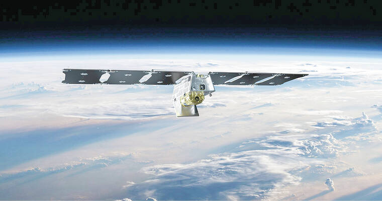
The Earth Fire Alliance’s satellites will join similar missions from NASA and the National Oceanic and Atmospheric Administration. The agencies announced this week that they will soon launch GOES-U, the last in their series of four advanced weather satellites, which provide continuous monitoring of much of the Western Hemisphere.
Roughly the size of a small school bus, the GOES-U satellite was designed and built in partnership with defense contractors Lockheed Martin and L3Harris. It will lift off on June 25 aboard a SpaceX Falcon Heavy Rocket from NASA’s Kennedy Space Center in Florida, and will provide rapid data for tracking severe storms, including destructive wildfires and their smoke, as well as tropical systems, floods, lightning, snowstorms, dense fogs and other hazards, officials said.
“NOAA’s geostationary satellites are an indispensable tool for protecting the United States and the 1 billion people who live and work in the Americas,” Pam Sullivan, director of NOAA’s Office of Geostationary Earth Orbit Observations, told reporters Wednesday.
GOES-U — which will be renamed GOES-19 once in orbit — will scan the Earth every 10 minutes, and can zoom in to track dangerous storms and hazards with 30-second updates, she said.
It will also carry the first operational compact coronagraph that will help detect space weather for early warnings of disruptions to power grids, communications and navigation systems. Earlier this month, a powerful geomagnetic storm prompted some reports of such impacts.
The GOES series will play a critical role in hurricane tracking, but perhaps its “biggest game-changing aspect” is its ability to detect wildfires, said Dan Lindsey, a program scientist with NOAA.


Get the Latest News
Most Popular
