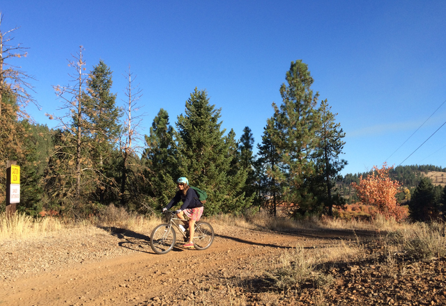
NEW MEADOWS, Idaho — No matter how speedily things are moving in the outside world, the pace is slow and steady on central Idaho’s Weiser River Trail, a converted rail bed that runs 85 miles (137 kilometers) between two small towns in one of this state’s most beautiful areas.
The trail takes travelers through forest, orchards, ranchland, and then, in the southern portion, through spectacular sagebrush canyons with black lava cliffs.
I rode the trail with my family, starting at the upper end, about 2,000 vertical feet (600 meters) above the endpoint in Weiser. (It would be all uphill if you went in the other direction.)
The Pacific & Idaho Northern railroad company, or P&IN, blazed the trail through the landscape around the turn of the 19th century, reaching the small town of Council in 1901, according to a recent history of the area by Dale Fisk, the editor of the local Adams County Record newspaper.
The railroad was built to take travelers between the city of Boise and the four small towns of Weiser, Midvale, Council and Cambridge. It carried Gold Rush fortune-hunters up to the mountains, and took copper ore from the mountain’s mines back to the city.
Things are a little quieter around the trail these days. Union Pacific deeded the right-of-way to the nonprofit group Friends of the Weiser River Trail in August 1997, and the Friends have worked hard to maintain the rail bed for runners, walkers, hunters and bikers.
Signs of recent bear traffic are everywhere. When we traveled the wide, graded path last fall, we ran into few other humans – just a quartet of bow-hunters on bicycles who were scoping out the territory, and some apple-pickers checking out the harvest. Friends who rode it in late September met cowboys herding cattle down the trail.
Starting at the upper end of the trail, the trail gets off to an unprepossessing start on an unmarked dirt road just off Highway 95 near the small town of New Meadows. It quickly enters the woods, passing over streams on exquisite trestle bridges that have been remade for bicyclists. The trail passes by the Tamarack Lumber Mill and its colossal log yard before heading away from the road.
Riding the Weiser River Trail is serene, but it isn’t easy. The Friends group uses a mechanical roller to flatten the terrain, but they can’t pave it; not only do they not have the money, but some of their most fervent supporters ride horses on it. So for bikers, the terrain is packed dirt, soft enough to slow progress, and is occasionally studded with rocks. Cattle gates cause frequent stops.
But the beauty and surprises of traveling so far from roads more than make up for the labor of riding the bumps. Around Fruitvale, the trail was lined with overloaded apple trees. A local man who was collecting apples told us the trees were from Fruitvale’s days as a minor orchard area.
The trail also passes unexpectedly through a tidy water bottling operation housed in stone buildings and owned by the grocery store chain Whole Foods. This is the unheralded historic site known as Starkey Hot Springs, a business established a century ago by a dentist who installed a geothermally heated swimming pool that is still used by locals. Whole Foods purchased the springs in 2013 and restarted the water-bottling, providing a needed infusion of jobs in tiny Council.
For recreational bicyclists like our three-generation group, riding the trail is a two-day affair. There are Forest Service and other campgrounds available for overnights. One, at the trail’s Wye trailhead near the northernmost point, provides a hand pump and two horse corrals. We chose Mundo Hot Springs because it was just north of the town of Cambridge, about halfway along the trail, and because it has a large geothermal swimming pool where we could gratefully soak after our day on the trail.
The enticing thing about the Weiser River Trail is that it travels to places few people ever get to see, through river valleys that look almost untouched by humans, through cattle pastures where the animals and green trees appear recently washed by the rain. It also runs deep into Owyhee canyonlands, through miles of roadless area where birds of prey, elk, mule deer and bear shelter. If you have time to stop and fish the Weiser for a while, all the better.


