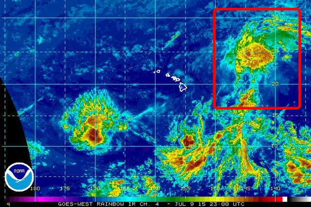
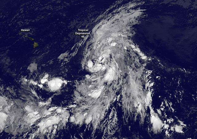
Tropical Storm Ela formed late Wednesday and reached its peak before weakening to a tropical depression Thursday afternoon. The weather system is forecast to pass far north of the Big Island this weekend. ADVERTISING Tropical Storm Ela formed late Wednesday
Tropical Storm Ela formed late Wednesday and reached its peak before weakening to a tropical depression Thursday afternoon. The weather system is forecast to pass far north of the Big Island this weekend.
The depression, located about 570 miles northeast of Kailua-Kona, was packing maximum sustained winds of 35 mph Thursday evening and was moving toward the northwest around 12 mph, forecasters with the Central Pacific Hurricane Center said. Ela peaked as a tropical storm packing 40 mph winds that stretched as far as 80 miles from its center.
Increasing southwesterly wind shear is forecast to continue weakening Ela, the first named storm of the 2015 Central North Pacific hurricane season. Forecasters expect to downgrade the weather system to a remnant low within 48 hours as it nears the western end of the state.
Though the Big Island will be spared from Ela’s effects for the most part, National Weather Service and U.S. Coast Guard officials cautioned of high surf and extreme sea conditions generated by the storm.
No tropical storm watches or warnings have been issued for the state.
A NWS high surf advisory will remain posted for east-facing shores of the Big Island’s southern, northern and eastern coastlines through 6 a.m. Sunday.
Wave heights of 6 to 8 feet are forecast. Surf is forecast to diminish rapidly starting Saturday night.
The U.S. Coast Guard advised mariners to monitor the progress and strength of the storm on VHF channel 16. Small craft advisories and warnings are also broadcast on VHF channel 16.
“Visitors to Hawaii should heed all warnings from lifeguards and public health and safety officials. Although weather conditions may be good, rip tides and high surf may impact beaches far in advance of the actual storm. Even the best swimmers can fall victim to the strong waves and currents caused by storms. Swimmers are urged to stay clear of beaches until local officials say the water is safe. Water conditions can also become contaminated due to runoff for several days following a storm,” the Coast Guard said in a prepared statement.
The Honolulu-based Central Pacific Hurricane Center was also monitoring two other areas of disturbed weather Thursday.
The first disturbance, an area of showers and thunderstorms 600 miles south of Hilo, could see some slow development during the next two days.
The second weather system comprising showers and thunderstorms about 925 miles southwest of Honolulu could see some development during the coming 48 hours. It had a 60 percent chance of development during that time period.
Elsewhere in the Central North Pacific basin, an area spanning north of the equator from 140 degrees west longitude to the international date line, no tropical cyclones are expected through Saturday morning.
In the Eastern Pacific basin, forecasters were monitoring two areas of showers and thunderstorms off the coast of Mexico. Both are forecast to become tropical depressions early next week.
The Central North Pacific and Eastern Pacific hurricane seasons continue through Nov. 30.
Get more hurricane-related content, including preparation tips, evacuation info and daily tropical weather updates, on our hurricane season page, sponsored by Clark Realty, at www.westhawaiitoday.com/hurricane-season-2015.


