Tropical Storm Guillermo bypassed Hawaii Island on Wednesday with a whimper, losing intensity as it continued on its northwestward track. ADVERTISING Tropical Storm Guillermo bypassed Hawaii Island on Wednesday with a whimper, losing intensity as it continued on its northwestward
Tropical Storm Guillermo bypassed Hawaii Island on Wednesday with a whimper, losing intensity as it continued on its northwestward track.
The National Weather Service discontinued the Tropical Storm Watch for Hawaii and Maui counties at 11 a.m., when Guillermo was located about 250 miles east-northeast of Hilo, displaying maximum sustained winds of 60 mph with higher gusts and moving to the west-northwest at 12 mph. Tropical storm force winds extended outward up to 185 miles from the center.
By 5 p.m., the storm had moved to about 225 miles northeast of Hilo, with maximum sustained winds slowing to 50 mph and forward movement slowing to 10 mph.
The storm was to continue moving to the west-northwest for the next couple of days, with a slight increase in forward motion Friday, according to the 5 p.m. Central Pacific Hurricane Center update.
“The center of Guillermo is expected to pass about 170 miles north of the Big Island and 125 miles north of Maui (today),” the update read.
“Steady weakening is expected over the next couple of days … with Guillermo expected to become a tropical depression by Thursday night,” it said.
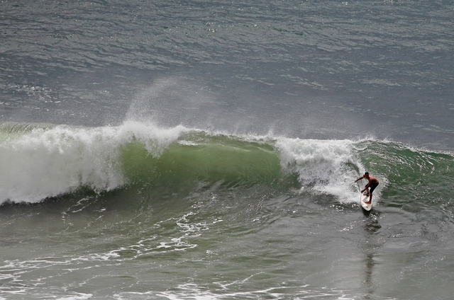
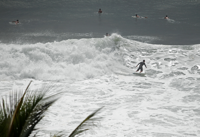
The update noted swells associated with the storm were expected to produce large, “life-threatening surf along east-facing shores of the main Hawaiian Islands over the next couple of days.”
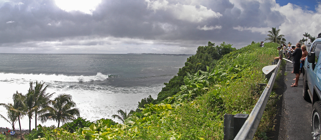
The heavy surf drew plenty of onlookers to Honolii Beach Park on Wednesday morning, as a few brave souls ventured out into the rolling waves. Sets there measured up to 20 feet on their faces at times, surfers said.
Emergency responders didn’t report any major incidents in regard to the storm, and Hawaii Electric Light Co. said it responded to a few isolated power outages in the past few days — many of which appeared to have been caused by well-intentioned attempts by homeowners to cut down troublesome trees in their yards in advance of the storm’s arrival, according to HELCO spokeswoman Rhea Lee-Moku.
“The only trouble we’ve had the last few days were small interruptions,” she said. “We had a few incidents where customers were cutting their own trees, and they probably fell on the lines and caused small outages. I think it was mostly people trying to be proactive.”
She said HELCO customers seeking to cut down trees in the future are free to call the utility’s trouble line and request their service lines be lowered and then raised again once the work is complete. That number is 969-6666.
The biggest power outage occurred Monday after an ironwood tree fell along the Hamakua Coast, breaking some power lines and equipment.
“We had about 3,000 customers impacted, but most were momentary, where the power may flick off and back on within a few seconds,” Lee-Moku said. “About 36 customers had extended outages.”
Hawaii County Civil Defense wasn’t alerted about any major incidents, according to Administrator Darryl Oliveira. The office is, however, keeping a close eye on another storm developing out to sea.
“We’re watching one off to the southeast. It hasn’t organized or formed enough to classify either as a tropical depression or anything yet, but we are watching it, maintaining close communications with the National Weather Service,” he said. “Depending on what happens going forward, we do have a statewide emergency management teleconference scheduled for Friday at 1:30 in the afternoon, and we’re basically anticipating this thing forming and becoming some kind of a system that could then be classified as a tropical cyclone.”
Email Colin M. Stewart at cstewart@hawaiitribune-herald.com.


