Updated map shows Kona, Naalehu areas with highest potential for dengue infection
Thursday, November 19, 2015 07:02 pm
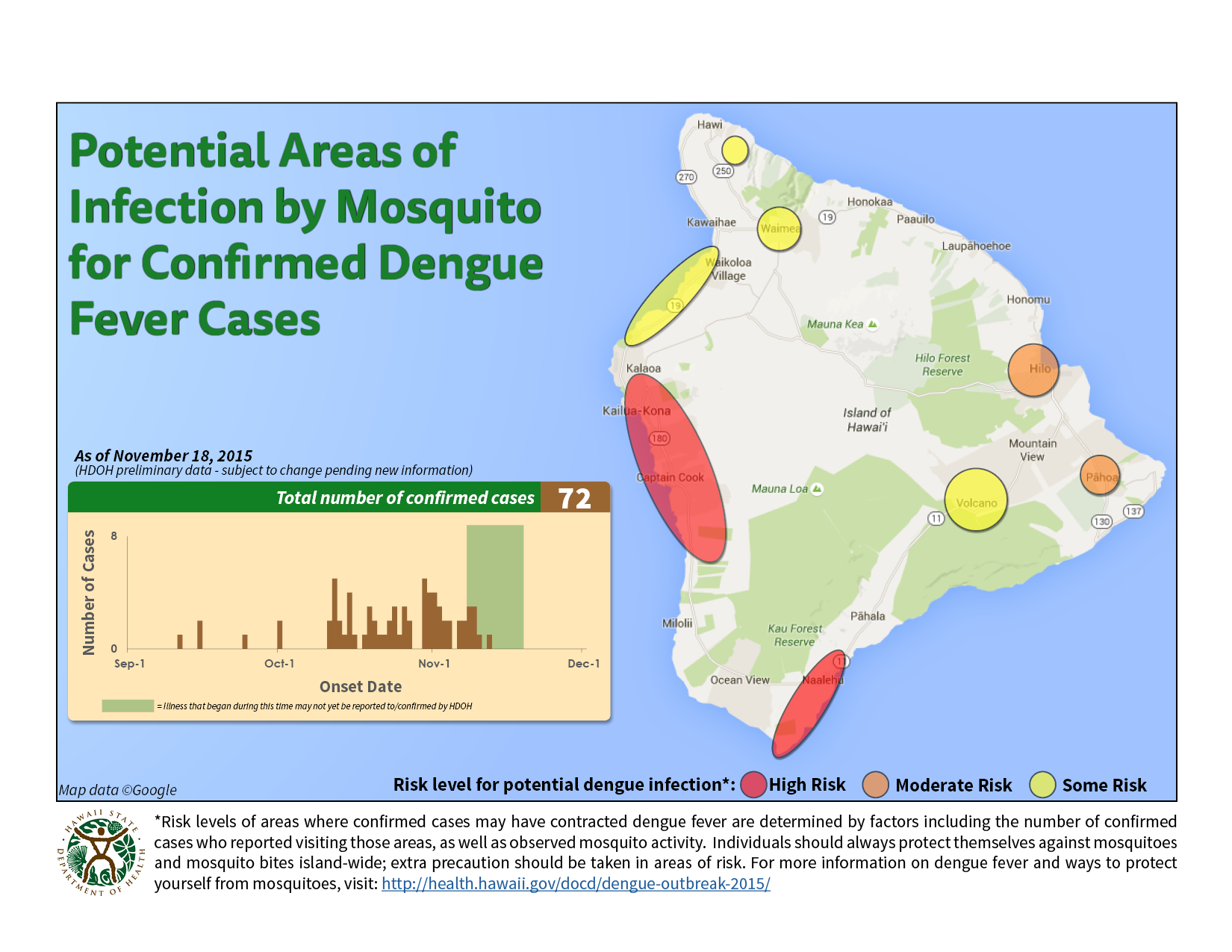
The Hawaii Department of Health has released an updated map showing potential areas for infection from dengue fever around Hawaii Island. The Hawaii Department of Health has released an updated map showing potential areas for infection from dengue fever around

Get the Latest News
Subscribe to our free email newsletters for daily updates delivered to your inbox.
View all our newsletters here.
Most Popular

Upcoming Events