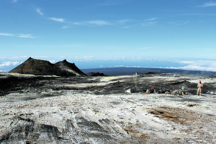
Volcano Watch: High-altitude station maintenance on Mauna Loa
U.S. Geological Survey trucks pull off the shoulder of Mauna Loa Observatory Road before dawn.
Volcano Watch: What was that ship doing by the 2018 lava deltas?
In late September, East Hawaii residents with ocean views might have noticed an unusual ship — too small for a cruise ship, too big for a fishing boat — sailing just offshore of the 2018 lava deltas along the Puna coast. It also entered Hilo Harbor, where it deployed several smaller boats that canvassed the bay within the breakwall.
Volcano Watch: Why do so many deep earthquakes happen around Pahala?
The USGS Hawaiian Volcano Observatory detects tens of thousands of earthquakes each year.
Volcano Watch: Geologic history of Mauna Loa’s southeast flank revealed in new map
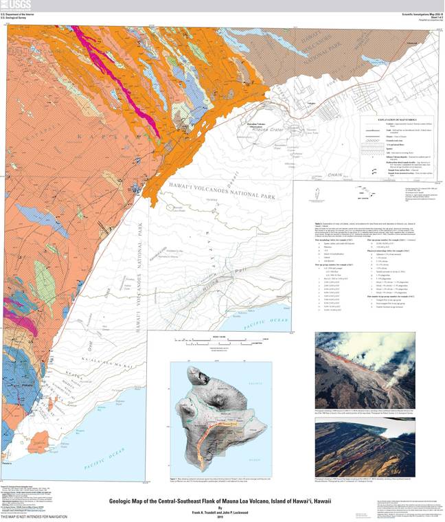
The recently published “Geologic map of the central-southeast flank of Mauna Loa volcano” is the culmination of years of field work by the U.S. Geological Survey. This updated map supersedes the “Geologic Map of the Island of Hawaiʻi” (1996) and the “Geologic Map of the State of Hawai‘i” for the Mauna Loa region.
Volcano Watch: How deep is the 2018 dike under Highway 130?
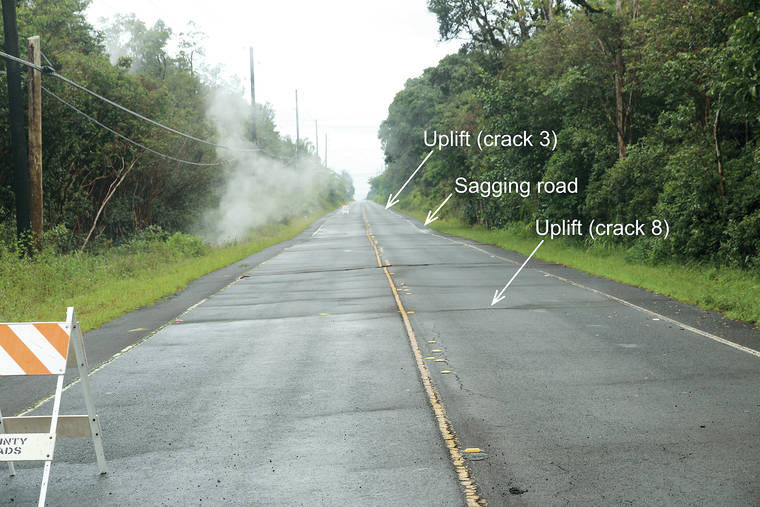
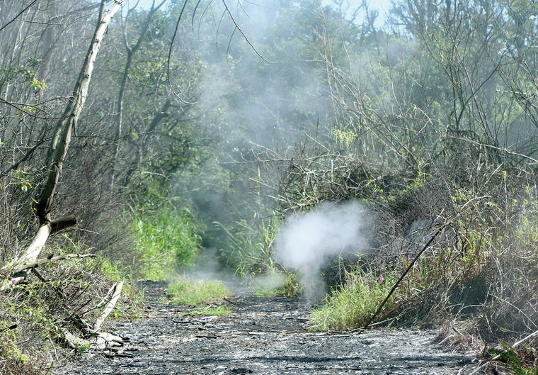
Even though Kilauea Volcano’s lower East Rift Zone eruption has been over for about a year, steam continues to appear in new places or reappear in old places, and vegetation continues to die because of lingering heat and steam in areas of the 2018 fissures.
Volcano Watch: HVO staff lend a helping hand to Alaska colleagues
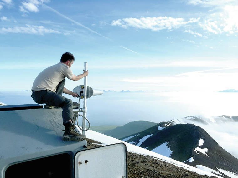
Volcano observatories throughout the United States work together to ensure efficient and thorough monitoring of the nation’s active volcanoes. This collaboration is particularly evident during a crisis, such as the 2018 eruption of Kilauea Volcano.
Volcano Watch: Volcano scientists gather for a volatile meeting
This week, a group of volcanic gas scientists from throughout the United States, including staff from the USGS Hawaiian Volcano Observatory, will gather at the Cascades Volcano Observatory in Vancouver, Wash., for a workshop to improve and facilitate collaboration within the volcanic gas community during times of eruption or volcanic unrest.
Volcano Watch: ‘Volcano Watch’ receives national award
“Volcano Watch,” weekly articles written primarily by U.S. Geological Survey Hawaiian Volcano Observatory staff and occasionally by USGS partners and university affiliates, was recently honored by the National Association of Government Communicators.
Volcano Watch: New research sheds light on relationship between Hilina fault system and large earthquakes
The pali (cliffs) of Kilauea’s south flank are some of the volcano’s most striking features.
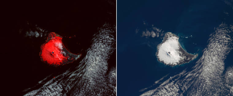
Volcano Watch: Sub-Antarctic lava lake spied from space
Last month, the entire world celebrated the 50th anniversary of Apollo 11’s triumphant flight to the moon and the first human footsteps on the surface of another planetary body on July 20, 1969.
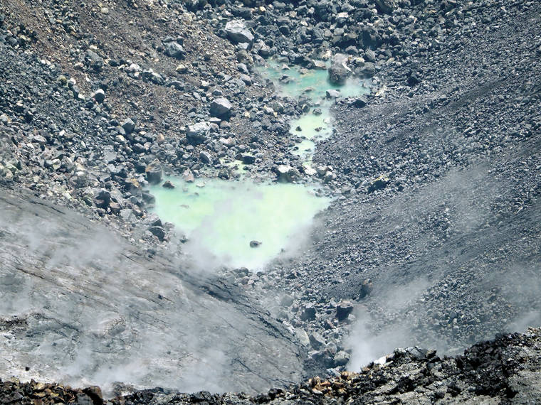
Volcano Watch: What does water in Halema‘uma‘u mean?
The slowly deepening pond of water on the floor of Halema‘uma‘u, the first in recorded history, has captured the interest of media and the public, locally and nationally. Many questions are being asked. The two most frequent are where is the water coming from and what is its importance.
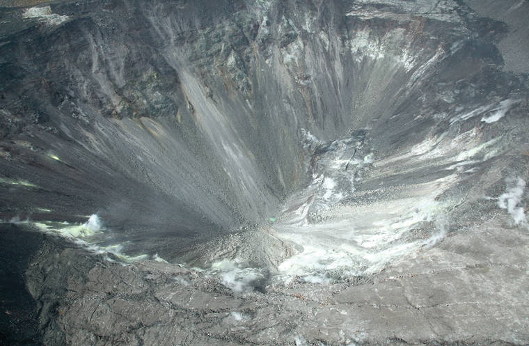
Volcano Watch: HVO now tracking ponds of water, not lava, at Kilauea’s summit
The recent appearance of water at the bottom of Halemaumau, a crater at the summit of Kilauea Volcano, has attracted wide attention and generated many questions.
Volcano Watch: Water or no water? That is — or was — the question
USGS Hawaiian Volcano Observatory scientists usually base their research on observations, either visual or instrumental. Interpretations come from these observations, so they must be as good as possible. Incorrect observations can lead, and have led, to erroneous interpretations.
Volcano Watch: Mauna Loa’s 1935 lava flow seen in current media coverage of Maunakea
In ongoing media coverage of demonstrations at the base of the Maunakea Access Road, many hundreds of people can be seen standing on a black lava flow that surrounds the Puʻuhuluhulu Native Tree Sanctuary adjacent to Daniel K. Inouye Highway. That same lava flow continues on the other side of the highway, which traverses the saddle between Mauna Loa and Maunakea.
Volcano Watch: Heat and gases linger on Kilauea’s lower East Rift Zone
One year ago, activity on Kilauea Volcano was remarkably different than it is today.
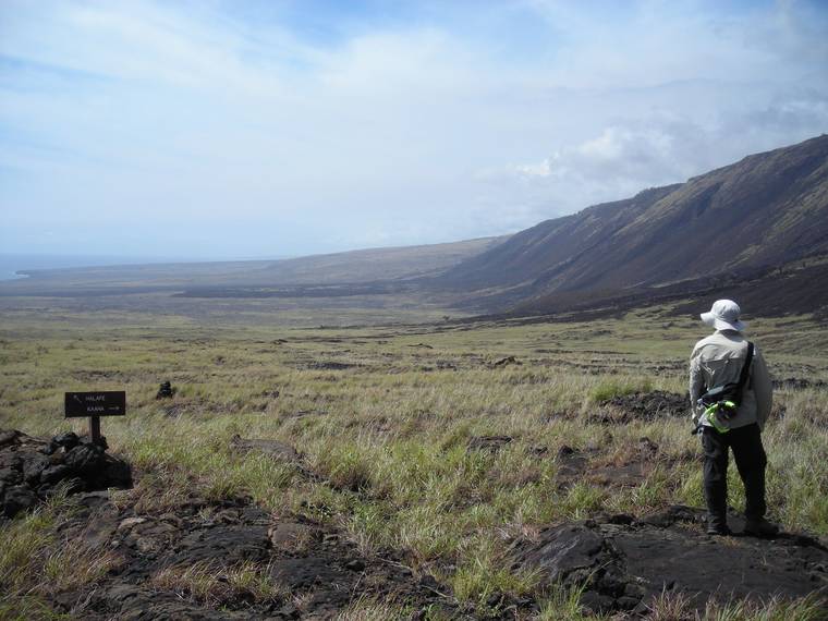
Volcano Watch: Mauna Loa’s 1975 eruption in terms of today’s Volcano Alert Level
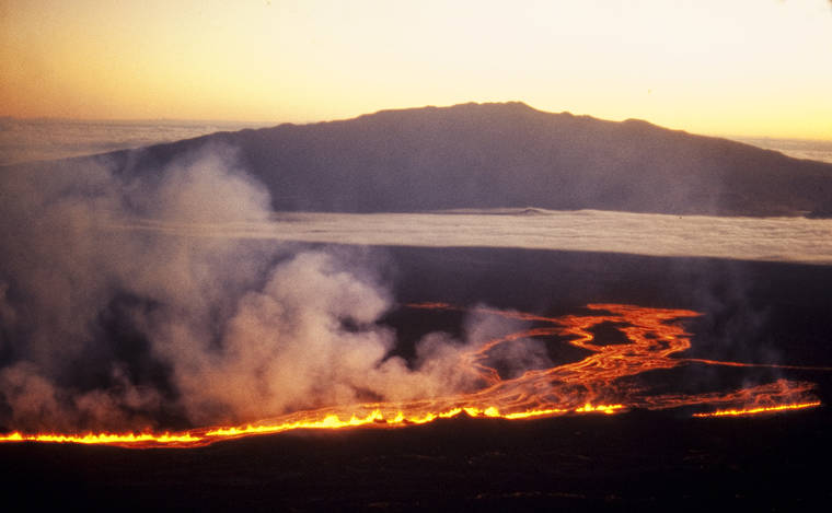
Shortly before midnight July 5, 1975, Mauna Loa Volcano awakened with a shudder.
Volcano Watch: USGS Volcano Notification Service informs island residents about Hawaiian volcanoes
Hawaii residents are likely familiar with the Volcano Activity Updates that the Hawaiian Volcano Observatory issues for Kilauea and other active Hawaiian volcanoes. These updates, which provide situational awareness of volcanic activity and hazards, were formally established in 2006.
Volcano Watch: Getting in the (rift) zone — why and how they erupt
Kilauea Volcano has two rift zones.
Volcano Watch: Reading the rainbow; How to interpret an interferogram
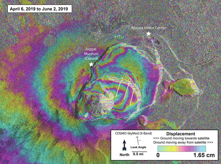
Since the early 1990s, scientists have used radar satellites to map movement, or deformation, of Earth’s surface.
Volcano Watch: Seeing the Earth shake on your screen
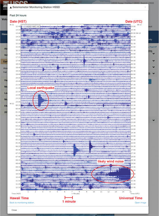
The USGS Hawaiian Volcano Observatory, along with its partners at the National Oceanic and Atmospheric Administration’s Pacific Tsunami Warning Center and the National Strong-Motion Project, operates a network of seismic monitoring stations on the Island of Hawaii and throughout the state.

